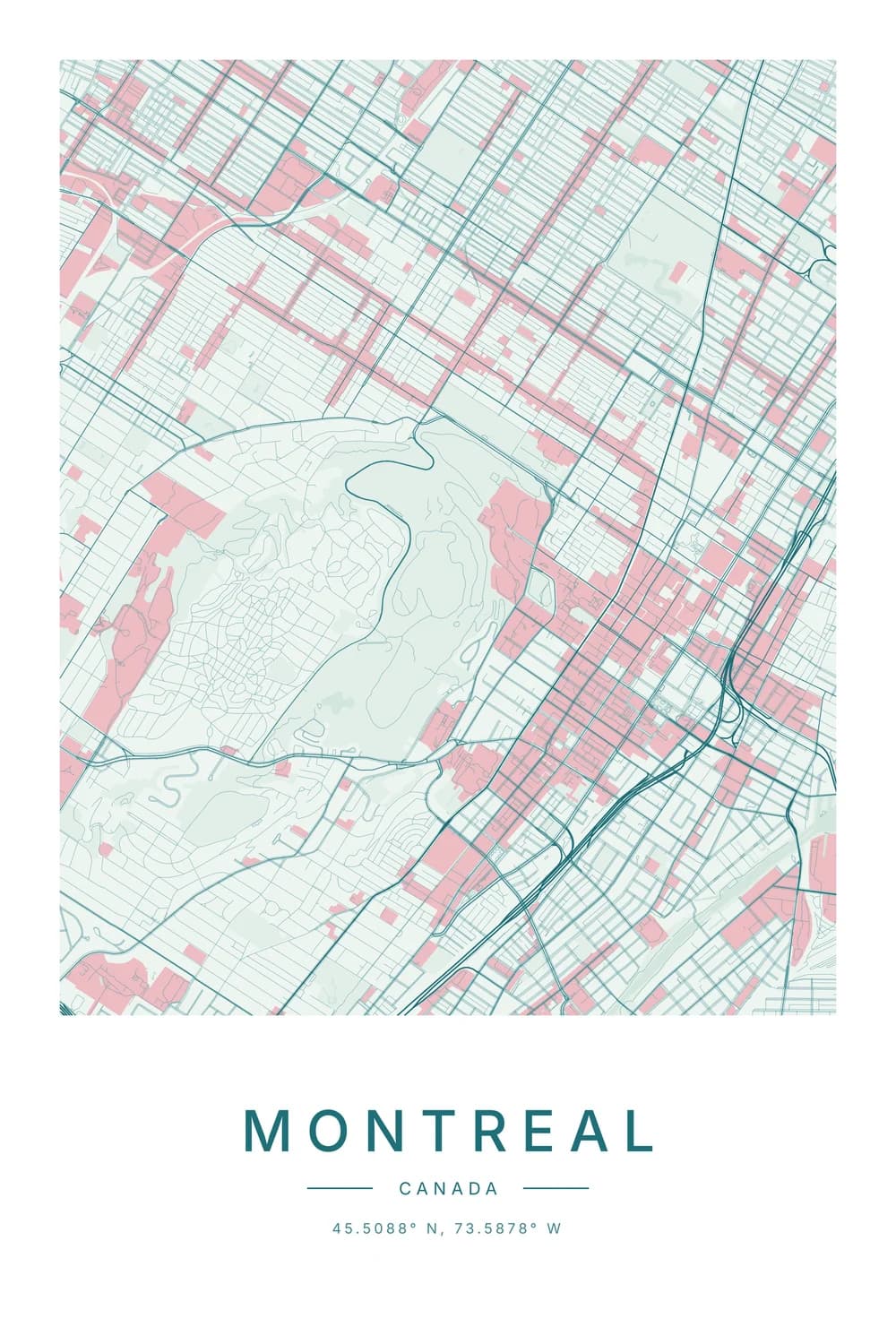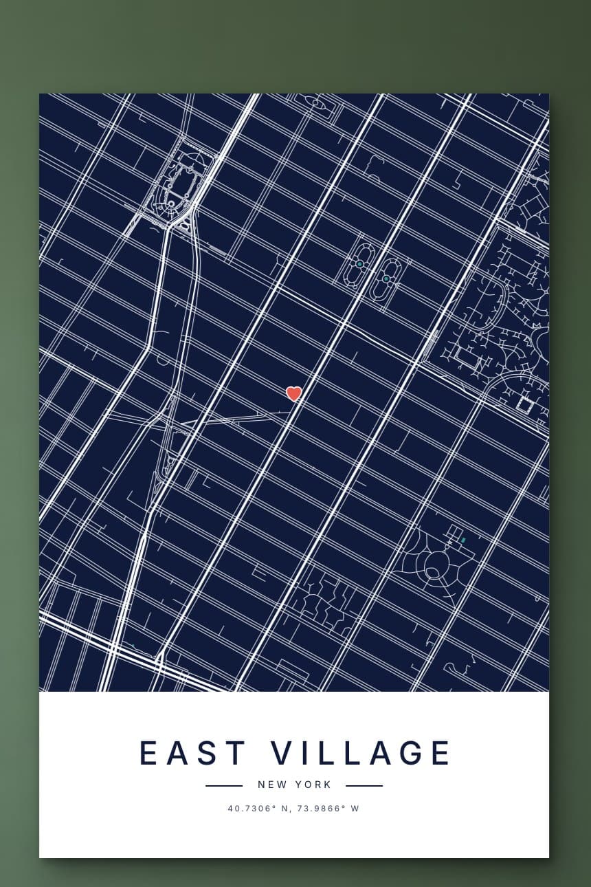
To make a city map poster, you need three things: the place, a clean style for the streets, and a file big enough to print sharply. You can do it for free with a little effort, or in a few minutes with a map maker built for posters.
Below we compare the free options honestly, then walk through making one in our maker, step by step, with screenshots.
The free ways to make a city map poster
Plenty of people make their own, and if you enjoy tinkering, it can be fun. Here is what each route is really like.
A screenshot of an online map
The quickest option is a screenshot of Google Maps or Apple Maps. It is fine for testing an idea, but it rarely prints well.
Screens show a few hundred pixels across, and a sharp poster needs thousands. You also get every label, bus stop and restaurant icon, and map providers’ terms usually limit what you can do with their images.
A design app like Canva
Design apps let you add a title and a frame around a map image. They are good at the text, but the map still has to come from somewhere, usually that same screenshot.
Open map data and free tools
OpenStreetMap, the free map of the world built by volunteers, lets anyone use its data. Tools such as Mapbox Studio or the open-source prettymaps can turn it into beautiful posters.
They are powerful and free, but expect an afternoon of learning. Exporting a file large enough to print is often the hardest part.
Free and paid, at a glance
- Screenshot: free and instant, but soft when printed and full of labels.
- Design app: free or cheap, great for text, but the map is still a screenshot underneath.
- Open-source tools: free and beautiful, but an afternoon of learning and some trial and error.
- A poster maker: minutes instead of hours, files sized for print, and you pay for the download.
How to make a city map poster in our maker
Our city map maker draws the real streets from OpenStreetMap in eight designs, and shows your poster on a wall as you build it. There are four steps.
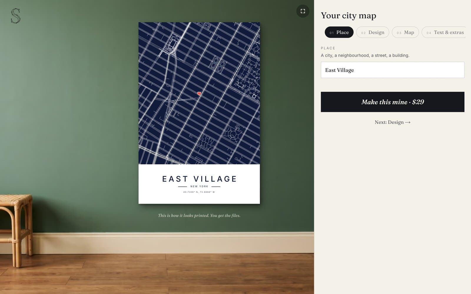
Step 1: Choose the place
Type a city, a neighbourhood, a street or even a single building. The map frames the place automatically, using its real outline.
Big cities work best zoomed into one area. A small town often looks best whole, with its river or coastline showing.
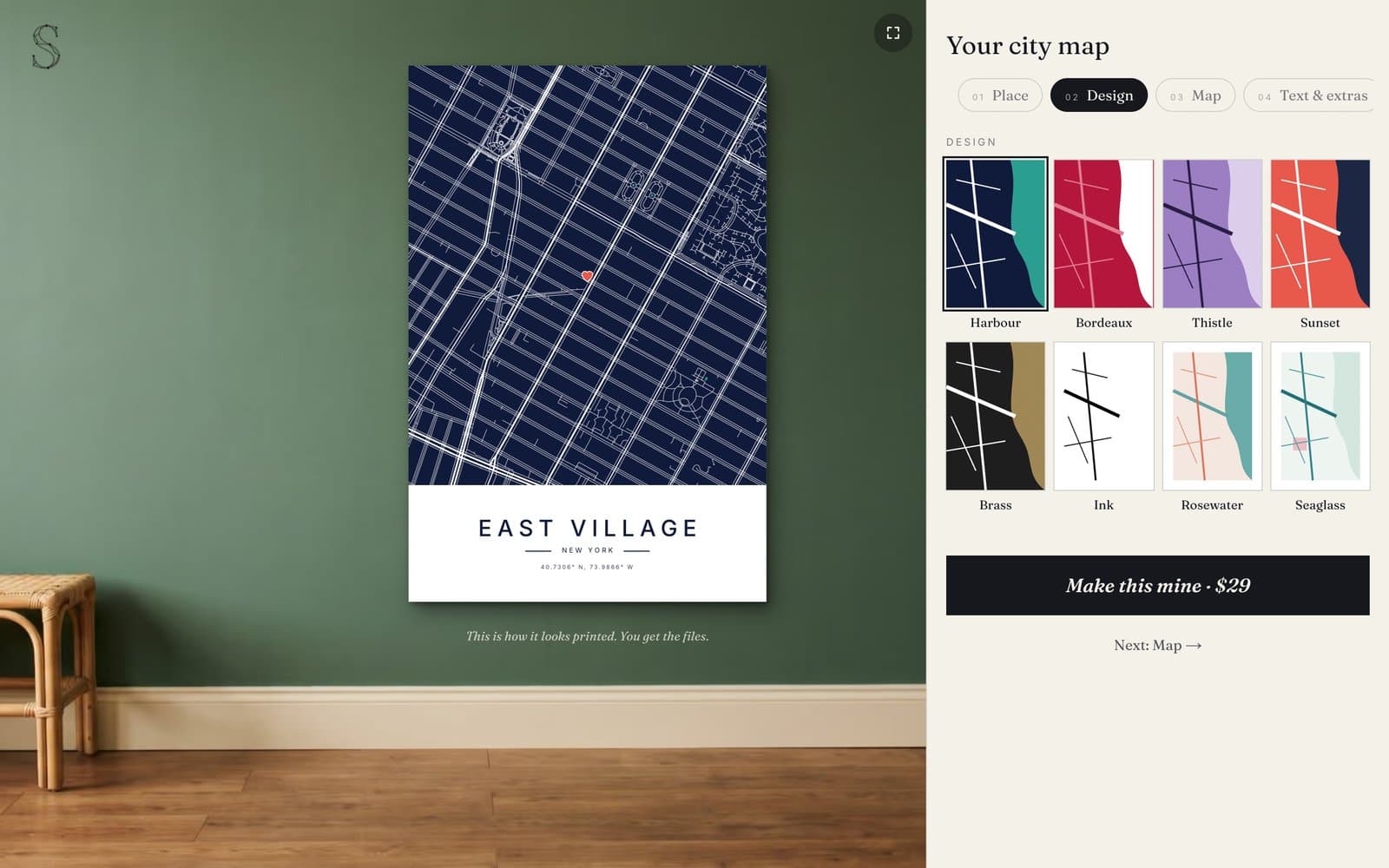
Step 2: Pick a design
There are eight designs: Harbour, Bordeaux, Thistle, Sunset, Brass, Ink, Rosewater and Seaglass. Each one colours the land, the water and the roads differently.
Choose for the room it will hang in. Dark designs like Harbour and Brass stand out on pale walls, while Ink and Seaglass suit calm, light rooms.
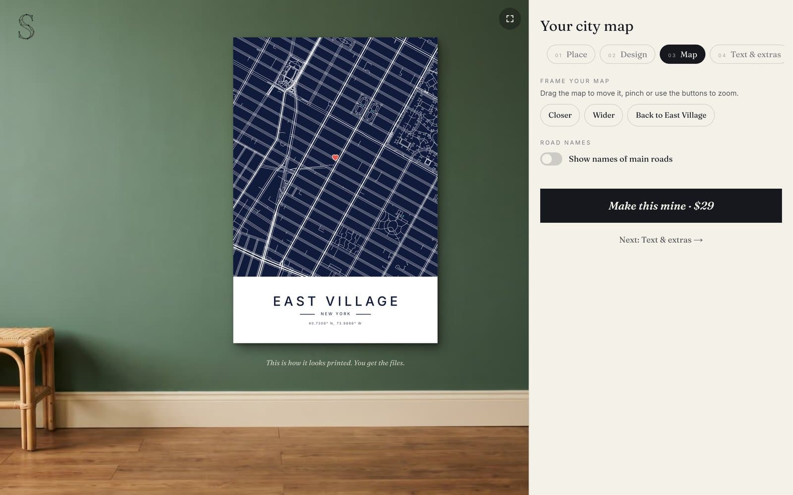
Step 3: Frame the map
Drag the map to move it, and scroll or pinch to zoom, or use the Closer and Wider buttons. What you see on the wall is exactly what prints.
You can also switch on the names of main roads. Most people leave them off for a cleaner look, but they help on maps of a single neighbourhood.
Step 4: Add your words and a marker
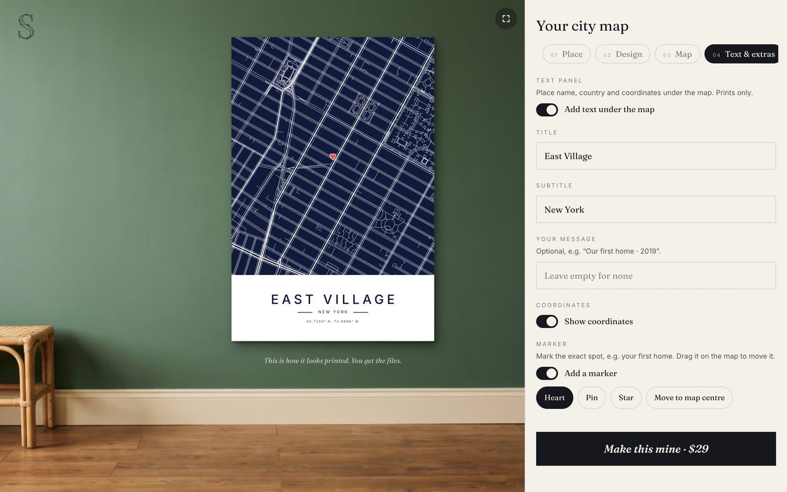
Under the map there is room for a title, a subtitle and a short message, such as “Our first home · 2019”. The coordinates of the place can print underneath too.
Add a heart, a pin or a star, then drag it onto the exact spot. For wording ideas, see what to write on a map gift.
Tips for a better-looking map
Give the eye somewhere to land
The best city maps have one strong feature: a river, a coastline, a park or a big roundabout. Nudge the frame until something like that sits in view.
Watch the edges
A landmark cut in half at the edge of the poster looks accidental. Move it fully in, or fully out.
Zoom for the story, not the city
If the poster is about one flat or one café, zoom in until the surrounding streets are readable. If it is about the whole city, zoom out until its shape appears.
Look at it full screen
Click the wall in our maker to see the poster large, the way it will look across a room. Thin streets that look busy on a phone often look lovely at full size.
What you get, and how to print it
When you are happy, the download is $29. You get 12 files: four print sizes from 8 by 10 up to 24 by 36 inches, plus phone, tablet and desktop wallpapers and two sizes for social media.
The print files are large enough to stay sharp at full size. Take them to a local print shop, upload them to any online print service, or print the smaller sizes at home on good paper.
Choosing a size
- 8 by 10 inches: a desk, a shelf, or a small gift frame
- 12 by 16 inches: a hallway or bedroom wall
- 18 by 24 inches: above a desk or a chest of drawers
- 24 by 36 inches: above a sofa or a bed, where it can really show off
Making it a gift
City maps are one of the easiest personal gifts to get right. You only need to know one place that matters to the person, and most people talk about theirs constantly.
Because the files arrive within minutes, there is no shipping to wait for. Print it, frame it, and it is ready to wrap the same day.
For more on the gift side, see our personalized Christmas gifts for couples.
Ideas for your first city map poster
Most people start with a place that means something: a hometown, a first home, or the city where they met someone. Our guide to the where we met map covers that one in detail.
Others pick a city simply because its streets are beautiful. Grids, rivers and old tangled centres all look different, as our post on why cities are built on grids shows.
Need an exact spot first? The free coordinates finder shows any place as a live map, and its “Make this a poster” button opens the maker on the same spot.
FAQ
How can I create my own city map?
Type the place into a city map maker, choose a design, frame the streets and add your words. Ours is free to use, and the print files are a $29 download.
How can I make a map poster for free?
You can screenshot an online map and add text in a design app, or use free tools built on OpenStreetMap data. Screenshots rarely print sharply, and the open-source tools take some learning.
What resolution does a city map poster need?
About 300 pixels per inch for close viewing, so a 24 by 36 inch poster wants roughly 7,200 by 10,800 pixels. That is why screenshots, at a few thousand pixels at most, look soft when printed large.
How much does a custom city map poster cost?
Printed and shipped map posters often cost $40 or more before framing. Our digital version is $29 for 12 files, and you print it wherever suits you.
Where does the map data come from?
Our maps are drawn from OpenStreetMap, a free map of the world built by millions of volunteers. It is detailed down to footpaths in most cities.
Can I make a map of a small town or a single street?
Yes. Search any village, street or building, then zoom in or out until the framing looks right. Small places often look best with a river, a coast or the edge of town in view.