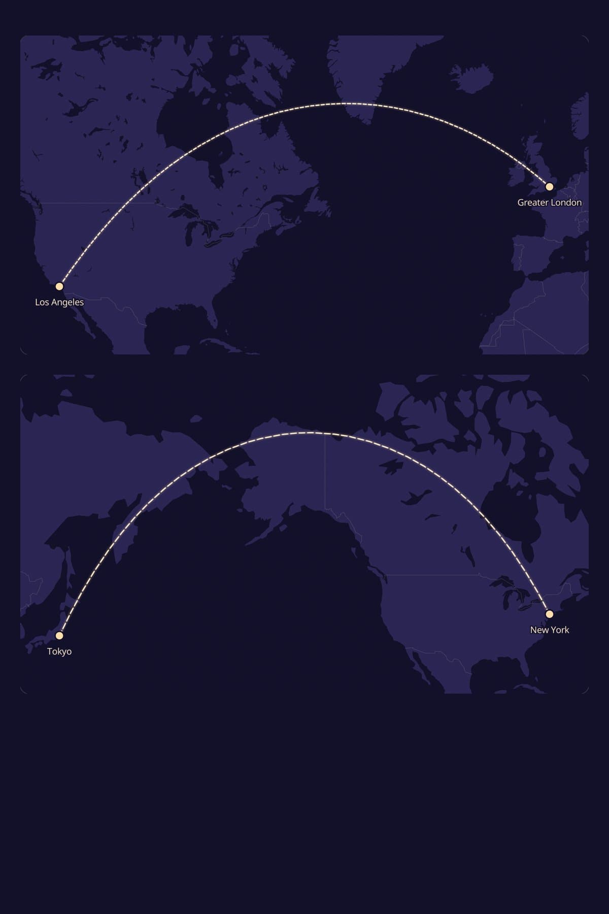
Flight paths look curved because flat maps can’t show a round planet honestly. The route a plane flies is the shortest line across the globe, called a great circle, and a flat map has to bend it to fit.
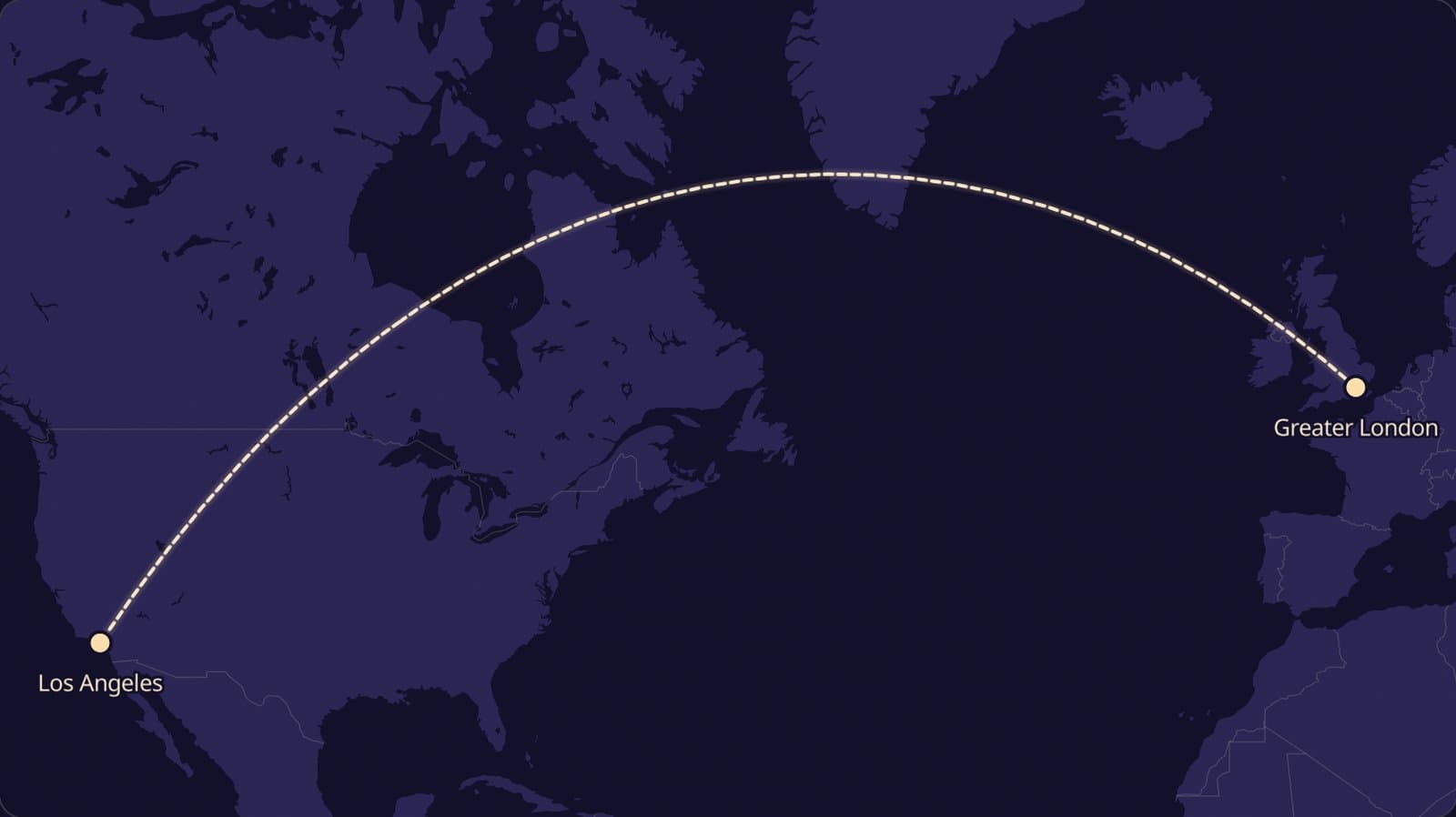
So the arc from London to Los Angeles that swings up past Greenland isn’t a detour. It is about 980 km shorter than the “straight” line you would draw with a ruler.
Here is why that happens, which way the curves bend, and the few reasons real planes sometimes wander off even the curved line.
The shortest line on a ball isn’t straight on paper
Try this with an orange. Draw two dots on it, then stretch a piece of string tightly between them.
That tight string is the shortest route. Now peel the orange and press the peel flat, and watch the string’s path go crooked as the peel tears and stretches.
Every flat world map has the same problem. You cannot flatten a ball without stretching some parts, so some lines that were straight on the ball end up bent.
What a great circle is
A great circle is any circle that slices the Earth into two equal halves. The equator is one, and so is every line of longitude running through both poles.
Between any two cities there is exactly one great circle that passes through both. Following it is the shortest way to get from one to the other, which is why pilots and airlines care about it so much.
Why the curves bend towards the poles
Most online maps, Google Maps included, use the Mercator projection. It was designed in 1569 for sailors, and it has one famous quirk.
Mercator stretches everything more and more the further it gets from the equator. That is why Greenland looks about the size of Africa, when Africa is really around fourteen times bigger.
Because the north is stretched so much, the true shortest path looks like it climbs north, skims the top, and comes back down. On the globe it hasn’t climbed at all; it has just cut across the narrow top of the world.
Northern routes bow north, southern routes bow south
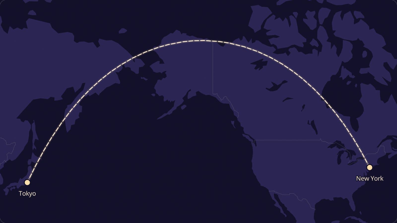
In the northern half of the world, routes bulge towards the North Pole. That is why Tokyo to New York heads up over Alaska rather than across the middle of the Pacific.
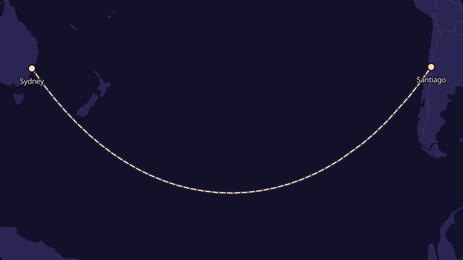
South of the equator it flips. Sydney to Santiago swings down towards Antarctica, making a smile shape instead of a frown.
The only routes that stay straight on the map are ones that run exactly along the equator, or due north and south along a line of longitude.
How much shorter is the curved route?
The “straight” line on a Mercator map isn’t useless. It is a route where you hold one compass heading the whole way, which made life easy for sailors with a compass and no computer.
Navigators knew the curved route was shorter centuries ago. The catch was that following it means changing your heading all the time, which is hard with only a compass and a paper chart.
So many split the difference, sailing a chain of short straight legs that roughly traced the curve. Modern planes simply let the autopilot do the bending.
It is just longer, sometimes by a lot. Here is what the curve saves on a few routes:
- New York to London: 5,570 km on the curve, about 220 km saved.
- Los Angeles to London: 8,756 km, about 980 km saved.
- Sydney to Santiago: 11,347 km, about 1,440 km saved.
- Tokyo to New York: 10,852 km, about 1,940 km saved.
The longer the trip and the further from the equator, the bigger the saving. Two thousand kilometres is more than two hours of flying, and a lot of fuel.
How to see it for yourself
You don’t have to take our word for any of this. There are three easy ways to watch a straight line turn into a curve.
Use a globe and a piece of string
If there is a globe anywhere in your house, stretch a string tight between London and Los Angeles. It runs up over Canada and past Greenland, exactly like the arc on the map above.
Now try Tokyo and New York. The string heads straight for Alaska, which looks absurd on a flat map and completely obvious on the globe.
Zoom all the way out on Google Maps
On a computer, Google Maps turns into a globe when you zoom out far enough. Right-click a city, choose “Measure distance”, then click a second city on the other side of the world.
The measuring line comes out as a curve. Spin the globe so the line faces you and the curve straightens itself out.
Draw it on a world map
Our distance tool draws the great circle between any two places you type in. Pick two cities far apart and both far from the equator, like Seattle and Dubai, for the most dramatic bend.
Why real flights don’t follow the curve exactly
The great circle is where planning starts, not where it ends. If you watch a live flight tracker, plenty of planes drift off the perfect arc.
Wind
High up, strong winds called jet streams blow from west to east. Flights heading east ride them, and flights heading west steer around them.
That is why New York to London is usually about an hour quicker than the trip back. Across the North Atlantic, the tracks planes use are redrawn every day to follow the winds.
Safety rules
Planes with two engines must stay within a set flying time of an airport they could land at in an emergency. Over remote oceans, that can pull the route closer to land.
Closed airspace and weather
Countries can close their skies to some airlines, and storms move around. Since 2022, for example, many flights between Europe and East Asia have taken longer routes to avoid Russian airspace.
The same idea, for the people you love
Once you know the curve is the shortest way, those arcs on the seat-back screen look different. They are the most direct line between two places, drawn as honestly as a flat map allows.
If two cities matter in your story, the distance between cities tool draws that exact arc on a world map, and you can download the picture for free. It also works out the time difference and how long it would take to walk.
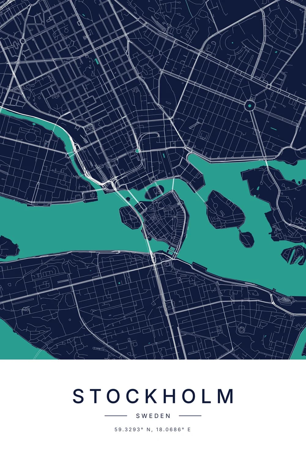
And each end of the line can become a city map poster of its own. Couples who live apart often hang one of each, an idea our long-distance star map guide covers for the sky as well.
Curious how the coordinates at each end work? Start with how to read latitude and longitude.
FAQ
Why are flight paths curved and not straight?
They are straight, on the globe. The shortest path across a ball is a great circle, and flat maps have to bend it to fit on the page, so it looks curved.
Why do planes fly over Greenland?
Because the shortest route between North America’s west coast and Europe passes close to it. Flat maps make Greenland look out of the way, but on a globe it sits right on the direct line.
Why can't planes fly in a straight line on the map?
A straight line on most world maps is a constant compass heading, not the shortest route. Following it from Tokyo to New York would add almost 2,000 km.
Do planes fly over the North Pole?
Some do. Routes between North America and Asia, or Asia and parts of Europe, can pass close to the pole when that is the shortest path and the weather allows it.
How do I see the shortest route between two cities?
Put both cities into the free distance tool and switch to the world map view. It draws the great circle route and shows the flying distance in kilometres and miles.