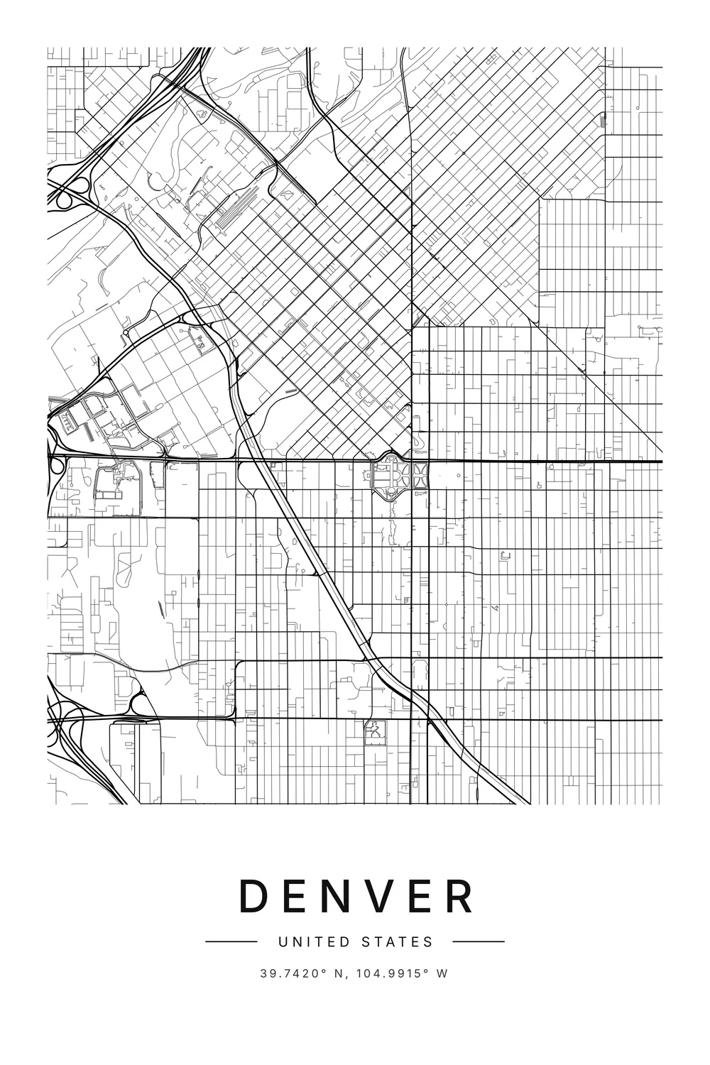
Cities are built on grids because grids are easy. They are easy to measure out, easy to divide into plots and sell, easy to build on, and easy to find your way around.
That is why grid plans turn up everywhere from a 4,500-year-old city in Pakistan to Manhattan. And it is why cities that grew without a plan, like Rome or London, look so different on a map.
Here is the short history of the grid, why American cities love it so much, and how to tell a planned city from a grown one at a glance.
A very old idea
The grid is not an American invention. People were laying out straight, crossing streets thousands of years before anyone had heard of New York.
The first grid cities
Mohenjo-daro, in what is now Pakistan, was built around 2500 BC with long straight streets crossing at right angles. It even had covered drains running under them.
In the 5th century BC a Greek planner called Hippodamus of Miletus made the grid his trademark. He is often called the father of town planning, and grid layouts are still sometimes named after him.
Romans, and an emperor’s capital
Roman army camps were always laid out the same way: two main streets crossing in the middle, with a grid around them. Many camps grew into towns, and Turin’s old centre still follows its Roman grid today.
On the other side of the world, the Chinese capital Chang’an was a giant grid. When Japan built a new capital in 794, it copied the plan, and that city is Kyoto.

Why grids won: the practical reasons
Land is easy to measure and sell
This is the big one. A grid cuts land into equal rectangles, and equal rectangles are easy to survey, number, price and sell.
When a town was being founded from scratch, the people founding it usually wanted to sell plots quickly. A grid let them do it from a map, before a single house went up.
It is quick to lay out
All you need to lay out a grid is a starting point, a measuring chain and a sense of direction. That made it perfect for colonial towns, railway towns and gold rush towns that appeared almost overnight.
Spain made it the law. Royal rules from 1573 told colonists in the Americas to build around a central square with straight streets, which is why so many Latin American cities share the same bones.
It is easy to find your way around
In a grid, if you go two blocks north and three blocks east, you know exactly where you are. Many grid cities number their streets, so the address alone tells you the way.
Why American cities love the grid
Most American cities were planned from scratch, quickly, by people who meant to sell the land. That is the perfect recipe for a grid.
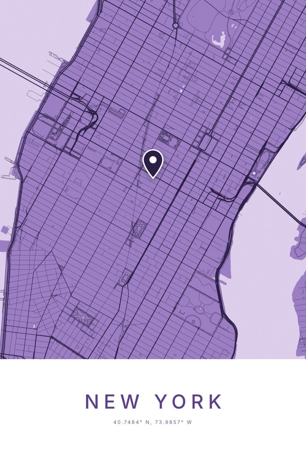
Philadelphia led the way in 1682, when William Penn laid it out in neat blocks between two rivers. Manhattan followed with its famous plan of 1811, which ruled a grid of avenues and numbered streets over hills and farms that were mostly still empty.
The whole country is a grid
In 1785 the young United States decided to survey its western lands into squares: townships six miles on a side, split into one-mile sections. That rule shaped the land long before most towns existed.
Fly over Iowa or Kansas and you can still see it. The fields are squares, and the country roads run a mile apart, north to south and east to west, for hundreds of miles.
Grids you can read like coordinates
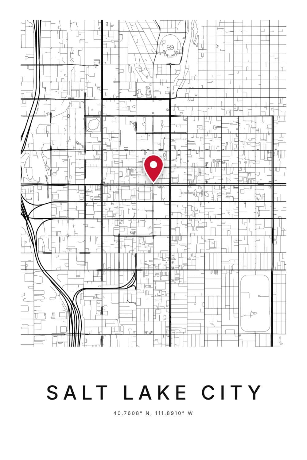
Salt Lake City takes it furthest. Its streets are numbered outward from Temple Square, so an address like “400 South 200 East” is really a pair of coordinates.
Its streets are famously wide too, about 40 metres. The story goes that they had to be wide enough to turn a wagon and a team of oxen around.
Chicago works a similar trick. Addresses count up from the corner of State and Madison, at 800 numbers to the mile, so locals can work out distances from an address. If you like that idea, our guide to reading latitude and longitude is the same thing for the whole planet.
Why some cities aren’t grids
Plenty of the world’s best-loved cities have no grid at all. They mostly have one thing in common: they are old, and they grew bit by bit.
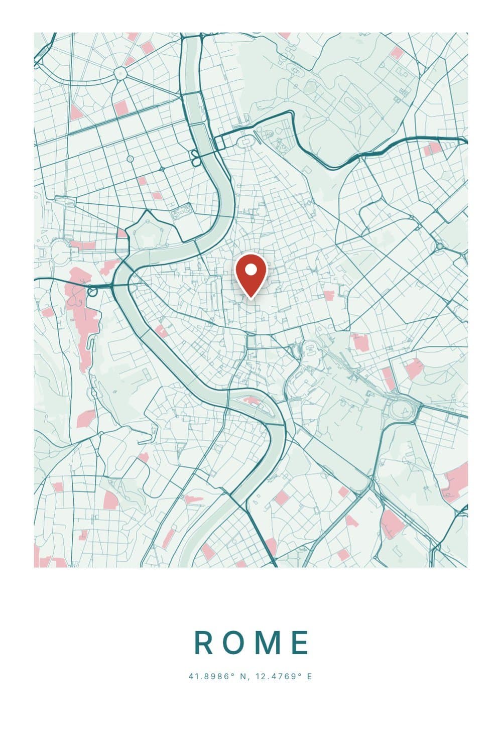
Rome, London and Paris before its 1800s rebuild all grew over centuries. Streets followed old footpaths, cart tracks, river banks and the easiest way around a hill.
London nearly got a grid once. After the Great Fire of 1666, Christopher Wren drew a grand new plan, but landowners wanted their plots back exactly where they had been, and the city was rebuilt on its old lines.
When grids go wrong
A grid drawn on paper doesn’t know about hills. San Francisco ran its straight streets right up slopes so steep that some sections are stairs, and Lombard Street had to zigzag to be drivable at all.
Critics also find big grids monotonous, and long straight streets invite fast traffic. Some newer suburbs went the other way entirely, with curving roads and cul-de-sacs, which are calm but hard to walk anywhere from.
The mixed cities
Many cities are both. Barcelona has a tangled medieval core and, around it, one of the most famous grids in the world, with its blocks’ corners cut off at an angle.
Kyoto, Turin and Mexico City keep ancient grids at their centres with newer growth around them. On a map you can often see exactly where the plan stopped and the city carried on by itself.
How to tell a planned city from a grown one
Next time you look at a map, check for these clues. They work on almost any town.
- Straight streets that ignore the land usually mean a plan. Streets that bend with a river or wrap around a hill usually mean growth.
- Numbered streets are a planner’s habit. Nobody numbers a lane that started as a cow path.
- A sudden change in pattern often marks a date: the old town walls, or the year a new district was laid out.
- One long diagonal through a grid is often an older road the planners kept, like Broadway in Manhattan.
Every city has a fingerprint
Once you start noticing, you can recognise many cities from their streets alone. Chicago’s relentless squares, Barcelona’s cut corners, Rome’s knot around the river bend.
That is a big part of why street maps make such good wall art. A city map poster of your town shows its history in its shape, whether that is a planner’s neat grid or a thousand years of shortcuts.
Want to look closer at one exact spot first? The coordinates finder shows any place as a live street map with its coordinates. And our guide to what N, S, E and W mean in coordinates explains the line printed underneath.
FAQ
Why are American cities built in grids?
Most were planned from scratch by people who wanted to sell land quickly, and a grid makes equal plots that are easy to survey and sell. A 1785 law that surveyed the West into square miles pushed the same pattern across the whole country.
Which major US cities have a grid system?
Manhattan, Chicago, Philadelphia, Salt Lake City, Phoenix, Denver and Portland are well-known examples. Boston, with its older, winding centre, is the famous exception.
Are grid cities better?
They are easier to navigate and usually easier to walk, because there are many routes between any two points. But they ignore hills and can feel repetitive, which is why many cities mix a grid with older, curving streets.
What was the first city built on a grid?
Mohenjo-daro, in today’s Pakistan, is one of the earliest known, built around 2500 BC. Ancient Greek and Roman towns later made the grid common across the Mediterranean.
Is New York City a grid?
Most of Manhattan is, thanks to a plan from 1811 that set out its avenues and numbered streets. The southern tip is older and much more tangled, and Broadway cuts across the grid on an old diagonal path.